In collaboration with students in the Indiana University of P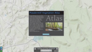 ennsylvania’s Department of Geography and Urban Planning, the CMNH GIS Lab has produced a vegetation atlas of the 20 most abundant tree species at Powdermill Nature Reserve. These maps are based on the extensive vegetation survey conducted at Powdermill from 2006-2008. The complete vegetation dataset is now available here as an ArcGIS personal geodatabase that can also be accessed using Microsoft Access.
Web Map
New Pennsylvania Unconventional Wells Web Map
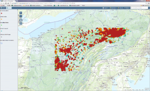
The Carnegie Museum of Natural History GIS Lab has produced a new web map to help researchers and the public to better understand the life of unconventional gas wells throughout Pennsylvania. The map uses the Carnegie Museum of Natural History Pennsylvania Unconventional Natural Gas Wells geodatabase to view information on permits, drilling, production over time, inspections, violations, and other information. View the map.
Macroinvertebrate Water Monitoring Map Wins Best App at PA GIS Conference
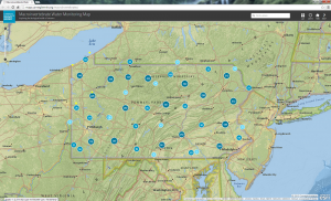
We are excited to announce that the Macroinvertebrate Water Monitoring Map won the Best App Award at the 22nd Annual Pennsylvania GIS Conference, held in State College, PA. The official announcement can be viewed here. We like to thank all those who voted for the app and the Planning Committee for all the work they do to provide this conference to the GIS community of Pennsylvania.
Powdermill Nature Reserve Map
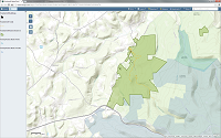
Check out the Powdermill Nature Reserve Map. You can explore trails and other local attractions such as state parks. Then bring your family to visit!