In collaboration with students in the Indiana University of P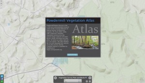 ennsylvania’s Department of Geography and Urban Planning, the CMNH GIS Lab has produced a vegetation atlas of the 20 most abundant tree species at Powdermill Nature Reserve. These maps are based on the extensive vegetation survey conducted at Powdermill from 2006-2008. The complete vegetation dataset is now available here as an ArcGIS personal geodatabase that can also be accessed using Microsoft Access.
Maps and Geographic Information Systems
![]()
One of the Four Carnegie Museums of Pittsburgh | ©2023 Carnegie Institute | Privacy Policy | Terms of Use | Accessibility
Get eNews
Our eNews features information on exhibitions, upcoming events, and subscriber-only special offers!