• Skip to primary navigation
  • Skip to main content

Powdermill Nature Reserve

Maps and Geographic Information Systems

Logo Carnegie Museum of Natural History

  • Home
  • About
  • Maps
  • Projects
    • Motus Terra – The Motus Station Viewshed Planning Tool
    • Pennsylvania Unconventional Natural Gas Wells
    • Unmanned Aerial Vehicle (UAV)
    • Powdermill Vegetation Survey
    • Historic Aerial Imagery
    • Childs Frick Abyssinia Expedition
    • Powdermill Nature Reserve Recreation Maps
  • Recent Posts

macroivertebrates

Macroinvertebrate Water Monitoring Map Wins Best App at PA GIS Conference

May 21, 2014 by James Whitacre

A map of Pennsylvania with blue dots showing monitoring areas spread across the state

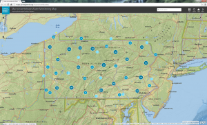
We are excited to announce that the Macroinvertebrate Water Monitoring Map won the Best App Award at the 22nd Annual Pennsylvania GIS Conference, held in State College, PA. The official announcement can be viewed here. We like to thank all those who voted for the app and the Planning Committee for all the work they do to provide this conference to the GIS community of Pennsylvania.

Filed Under: Web Map Tagged With: awards, Carnegie Museum of Natural History, macroivertebrates, Pennsylvania

One of the Four Carnegie Museums of Pittsburgh | ©2023 Carnegie Institute | Privacy Policy | Terms of Use | Accessibility
Get eNews

Our eNews features information on exhibitions, upcoming events, and subscriber-only special offers!