In collaboration with Civic Mapper, the Powdermill GIS Lab has captured fine-scale aerial imagery across various part of Powdermill Nature Reserve using an unmanned aerial vehicle (UAV). Imagery from two locations, the nature center and the avian research center, have been added as an optional layer to the Powdermill Nature Reserve web map. (Note: for best results turn off the Powdermill Nature Reserve boundary layer). The imagery was captured on October 29th and 31st using a Go Pro camera on a DJI Phantom 2 flying at 40 meters. If you would like either of the full mosaic images (with or without georeferencing), please contact the GIS Lab.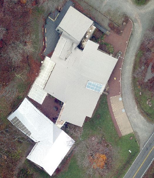
Maps and Geographic Information Systems
![]()
One of the Four Carnegie Museums of Pittsburgh | ©2023 Carnegie Institute | Privacy Policy | Terms of Use | Accessibility
Get eNews
Our eNews features information on exhibitions, upcoming events, and subscriber-only special offers!